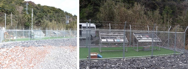
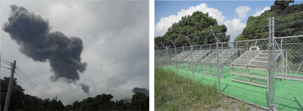
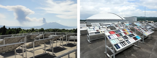
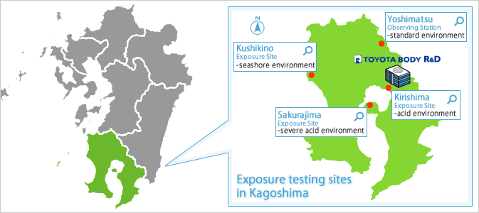
Exposure Testing Site Map
Weather Data
We take weather data at each exposure site.
| Item | Unit | Kirishima Exposure Site |
Sakurajima Exposure Site |
Kushikino Exposure Site |
Yoshimatsu Observing Station |
|---|---|---|---|---|---|
| Environment | — | acid environment |
severe acid environment |
seashore environment |
standard environment |
| Latitude | — | 31°41' N | — | — | — |
| Longitude | — | 130°49' E | — | — | — |
| Elevation | m | 322 | — | — | — |
| Avg. Temp. | ℃ | ○ | — | — | — |
| Avg. Max. Temp. | ℃ | ○ | — | — | — |
| Avg. Min. Temp. | ℃ | ○ | — | — | — |
| Avg. Ambient RH | % | ○ | — | — | — |
| Total Radiant Energy | MJ/m² | ○ | — | — | — |
| UV Radiant Energy (300-400nm) | MJ/m² | ○ | — | — | — |
| Amount of Rainfall | mm | ○ | — | — | — |
| Wind Speed | m/s | ○ | — | — | — |
| Wetting Time | h | ○ | — | — | — |
| PH Value of Rain Water | — | ○ | △※) | △※) | △※) |
| Ion Concentration in Rainwater (SO4²‾,Cl‾,NO3‾) |
mg/l | △※) | △※) | △※) | △※) |
| Amount of Ashfalls | g/m² | ○ | — | — | — |
| Amount of Sea salt aerosol | mgNaCl/(m²・d) | ○ | ○ | ○ | ○ |